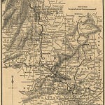
From 2014 to 2020, I designed and led hundreds of biking, walking and driving tours throughout Atlanta. For each of those tours, I did at least one "recon mission" to prepare for the tours. This is how I got to know the city so well. Since I was usually by myself on these recon missions, I was able to take my time. I often stopped to take photos and record videos like this. I even crashed a few times while peddling and recording (pre-GoPro).
Over the years, I have used many of my photos and videos to create interactive, multimedia maps like the one linked in the comments below. This is all part of the behind-the-scenes work that went into creating these exploration tools. I hope you find them helpful, and please share them with your friends.
Stay curious and keep exploring!


